
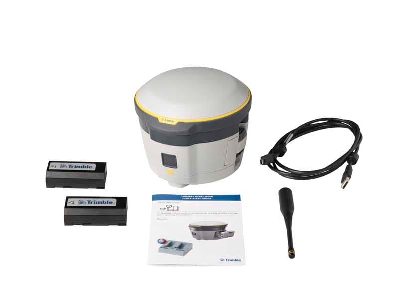
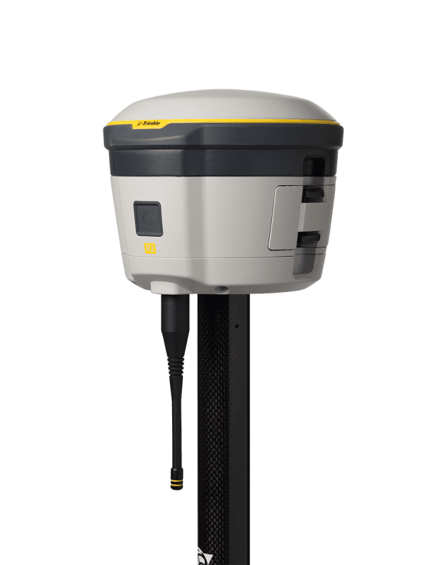
Trimble R2
/Trimble
Rs:
Trimble R2 Trimble
Accuracy for your data. Versatility in the field. Flexibility for your workflow. 10 mm H/20 mm V Max. Precision 220 Channels Integrated Antenna Receive UHF Radio The Trimble® R2 is a compact, durable GNSS receiver that provides an easy-to-use solution for GIS and survey professionals who need to collect highly accurate data in a wide range of geospatial applications. Capable of delivering between submeter and centimeter positioning accuracy in real-time to any mobile device via a wireless Bluetooth® connection, the R2 receiver gives you total flexibility to choose a solution based on the accuracy and GNSS performance level that suits your application, letting you work the way you want.
Professional solution for GIS & survey applications ranging from submeter to centimeter accuracies Easily collect data by pairing with devices such as smartphones, tablets or Trimble handhelds Fast to setup, easy-to-use, keeping you productive and focused on your work Supports multiple satellite constellations and correction sources for accurate data at any location Compact, cable-free design with integrated antenna High accuracy for survey & GIS applications Capable of delivering submeter to centimeter level positioning accuracy in real-time to suit any field data collection application. Achieve higher accuracy in real-time using correction sources from SBAS and VRS networks to Trimble RTX™ correction services*, delivered by either satellite or Internet, or via traditional RTK methods. Supports multiple satellite constellations and augmentation systems to provide maximum accuracy and positioning performance.
- Trimble RTX™ available through Trimble applications
Flexible solution Able to be paired with any mobile device on a variety of operating systems and platforms, from a Trimble handheld or controller to a modern smartphone or tablet. You can select the accuracy and GNSS performance level appropriate for your application. Capable of being operated either mounted on a pole, on a backpack or on a vehicle. Integrates with Trimble software such as Trimble Access™, Trimble TerraFlex™ and Trimble Business Center to enable data to be easily collected, communicated and processed, providing you with high-quality deliverables for your organization. Simple, rugged system One-button start up and compact, streamlined design enables a quick setup. Built to withstand tough conditions meeting military specifications MIL-810G for ruggedness and an IP65 rating. Category: GNSS


+977-9842496370
info@geosatsolutions.com.np
CTC MALL (CIVIL TRADE CENTER), Shop no 209, Kantipath, SUNDHARA, Kathmandu, Nepal, 44600